Our Work
Sydney Trains MIDT
Agonics experts accelerate the adoption of LiDAR in routine maintenance at Sydney Trains
Client
Sydney Trains
Location
Sydney, Australia
Challenge
Periodical infrastructure measurements will often see maintenance crews enter the danger zone, requiring expensive safe working resources. Under the Measurement Inspection Digital Twin Project (MIDT), Sydney Trains aimed to determine if LiDAR could replace manual measurements to optimise resourcing and reduce safeworking costs.
Solution
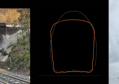
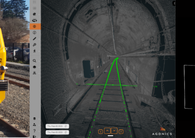
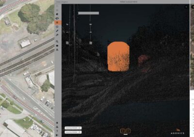
For a 60 km section of track, nine measurement use cases were identified including track centres, track alignment, ballast profile, platforms, structure gauge, sighting distances, and vegetation clearance.
The Agonics team worked closely with Sydney Trains’ SMEs to validate and refine technical requirements and reference data for each use case. Using XERRA, the Agonics LiDAR analysis software, measurement reports were generated across all nine use cases.
Outcomes
- All nine routine maintenance use cases were successfully validated.
- Critical reference datasets were refined.
- Sydney Trains received internal approval to transition to LiDAR-based reporting.
Download Full Case Study here
"*" indicates required fields
Related Projects
Sydney Trains MIDT
NTRO Level Crossing Assessments