Our Work
TasRail Network Asset Survey
MLS survey delivers critical digital datasets and clearance reports for TasRail systems
Client
TasRail
Location
Tasmania, Australia
Challenge
TasRail, state-owned entity that operates a 640 km narrow gauge railway in Tasmania, needed to update its digital network information to support network-wide clearance and track alignment assessments. The remote terrain and extensive network required careful planning to ensure the accuracy and completeness of the survey.
Solution
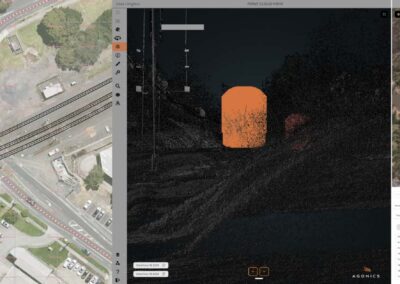
The Agonics team mobilised its MLS system onto a TasRail hy-rail and performed data recording over a 7-day campaign. High-density LiDAR point clouds and 360-degree digital imagery was collected with minimal impact on train operations.
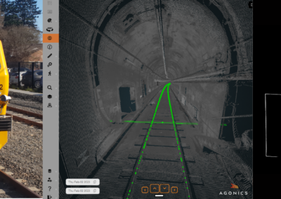
Extensive control point checks ensured the LiDAR data would meet accuracy requirements. The MLS data was processed and rendered into the Agonics XERRA Viewer, supporting project reporting back to TasRail.
Outcomes
- The project had zero OHS incidents.
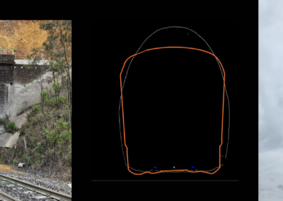
- Deliverables included updated track alignment data, encroachment (clearance) analysis using TasRail clearance templates, and colourised point clouds.
- A new digital track centreline was delivered for TasRail systems, including curvature and gradient information.
- The XERRA Viewer supports virtual corridor visits for TasRail employees.
Download Full Case Study here
"*" indicates required fields
Related Projects
Sydney Trains MIDT
NTRO Level Crossing Assessments